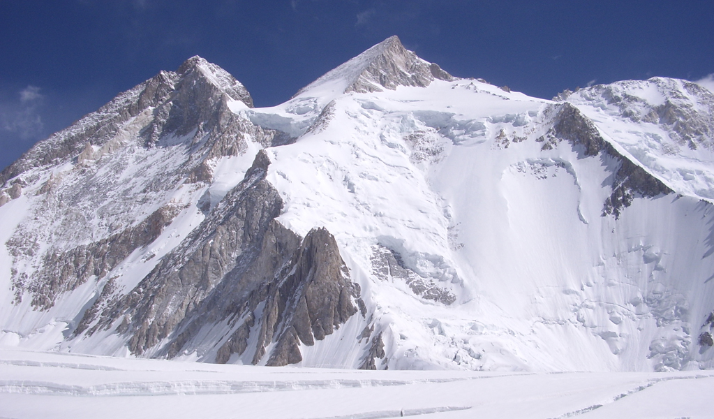
There are only 14 mountains on Earth that rise above whooping 8000 meters – collectively known as the 8000nders. They form our planet’s most formidable and rough frontier for climbers and scientists alike. These peaks are found entirely in the Himalaya and Karakoram ranges of Asia. The 8000nders challenge human endurance, shape regional weather, and stand as the world’s ultimate adventure.
Highest Peaks 8000nders: Nature has created these difficult-to-live and surpasses awfully high super structures with a definite purpose. Let us ponder. Billions of years ago the lonely SUN started spitting molten mass around, that cooled to form the planets in our Solar System. One such fireball ultimately became our Earth.
Table of Contents
Geographic analysis has proved that mountains are not just heaps of mud, but have very deep rocky roots in the Earth’s crust in proportion to height. They literally represent WEDGES pressed in to act as motion stabilizers.
Quick Facts About the Tallest Mountains on Earth
- Total number of 8,000-meter peaks: 14
- Highest Peak on Earth: Mount Everest (8,848.86 m)
- Primary ranges: Himalaya and Karakoram
- Countries sharing the peaks: Nepal, China (Tibet), Pakistan, and India
- Coldest 8000nders: K2 (temperatures drop below -40°C)
- Deadliest 8000nders: Annapurna I (fatality rate ~40%)
- Most climbed: Mount Everest (over 6,000 successful summits)
- First 8,000er climbed: Annapurna I (1950)
- Last 8,000er climbed: Shishapangma (1964)
What is the Highest Mountain in the World?
As you may already know the tallest peak in the world is Mount Everest, Peak Height: 8848m (29029 ft.). Keen observation of the Earth’s circumference (40’000km long) would show that there is only one long mountainous chain (Himalaya/Karakoram) in the world.
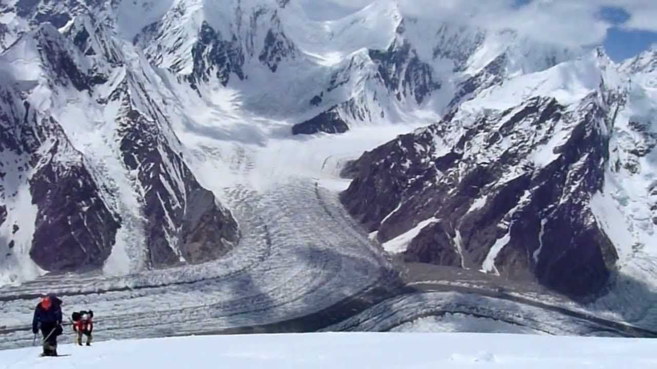
All of the highest 8000-meter peaks grouped within a few 100 kilometers. Ali Sadpara – a renowned mountaineer have summited eight of these 8000nders. These ranges could be the extra massive counterweight that our “Creator” added in this spot to smooth Earth’s rotation.
Why Are They Called the “8000nders”?
The term “8000nders” was first introduced by the International Climbing and Mountaineering Federation (UIAA). It refers to the 14 independent peaks over 8,000 meters (26,247 ft) in height above sea level. Each is a completely isolated summit, separated from its neighbors by deep cols (low points), so every individual 8000nders is a proper mountain in its own right, rather than just a subpeak or shoulder.
People appreciates with awe and feels the excitement of climbing them. A man has devised techniques to utilize these barren masses for mining, cultivation, wildlife hunting, tourism, and sports and loves to explore its landscapes, snow-clad peaks, deep valleys, and serene views.
Overall, travel is crucial for ultimate self actualization in life and hence its important for us to experience. We all must thank the ultimate Almighty for stabilizing Earth, otherwise, we would all be longing for a jerk-free sleep today.
The Geographical Reasons
The surface cooling was probably irregular and in stages, creating layers and causing cracks in the outer skin. This divided the crust into huge plate-like masses. These floating masses collided with further cooling and often overlapped, forming big heaps and pitches. The earth’s rotation around its axis could not stay uniform because of these moving crusts and started to wobble.
The wobbling shook the surface harder particularly along the equatorial circumference, pressing these plates and pushing the remaining softer sections to RISE, BEND, and TWIST as necessitated by the in-motion forces. Thus, forming the deep (Oceans) plateaus and mountains.
The mountains rose higher at places where the Earth needed extra weight and shrank deeper to shed weight to balance its wobble for a very very smooth jerk-free rotation, which we feel today. It took billions of years to become today’s cool and livable Earth. The atmosphere developed at later stages.
We can explain the above transformation in two simple examples.
- Put a big kettle in some liquid and some solid items randomly and rotate it. The uneven weight at some points will make it wobble. Soon the motion will adjust the solids by shifting and sliding, resulting in smooth even rotation.
- More than 50% of car drivers know that the old and often new tires wobble at certain speeds and must be balanced by adding extra weights at one or two points on the wheel for a smooth drive.
List of 14 Tallest Mountains in the World – 8000nders
Below are the list of highest peaks in the world with updated facts, records, and trivia (verified as of 2024 – 2025) 8000nders.
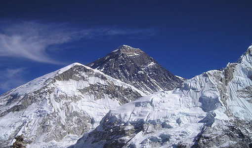
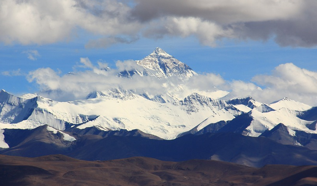
Mount Everest, Nepal’s Highest Point in the World
1st Highest peak among 8000ers Location: On the Nepal/China (Tibet) border in the Himalayan Range, Asia.

Key Facts & Records
- Peak name: Mount Everest, Survey Mark XV, Zhumulangma (Chinese). Known locally as Sagarmatha (Nepal) and Chomolungma (Tibet), both meaning “Mother Goddess of the Earth.”
- Elevation: 8,848.86 m (29029 ft.) (official updated measurement, 2020)
- First Ascent: Sir Edmund Hillary (New Zealand) and Tenzing Norgay (Nepal), 1953
- Coordinates: 27.9881° N, 86.9250° E
- Total Ascents: Over 6,000 successful summits by 2024
- Fatality Rate: ~3%
- Best Season: May–early June (pre-monsoon)
Interesting Trivia
Everest rises approximately 4mm per year as a result of tectonic uplift.
Mount Everest attracts high-altitude climbers worldwide. The novices are more enthusiastic to experience the thrill of the first climb. The more experienced ones improve their feats and guide the newcomers. A greater number come to Everest as it is far safer to climb as compared to K2 or Nanga Parbat.
Still, there are risky zones and allied dangers posed by climatic conditions, winds, and altitude sickness above 8000m. The climbing season starts before the monsoons and the wind speeds are less so reduce resultant risks. Also it is encouraged for climbers to start expedition wearing quality climbing pants and hiking boots so that the risks can be reduced.
Mountaineering on the highest peak is very costly. The experienced guides charge heavy fees for a turnaround climb. The Nepal government has a fixed permit fee of $US 25’000 per person. It is a good revenue source. Approximately 3’000 individuals have explored the Everest. Although less difficult still about 200 persons died, mostly while descending. Retrieving bodies from the death zone is simply impossible. They stay there where they fall and are often visible from climbing routes.
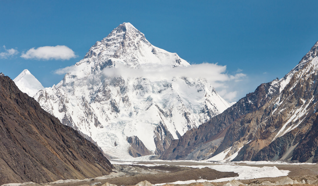
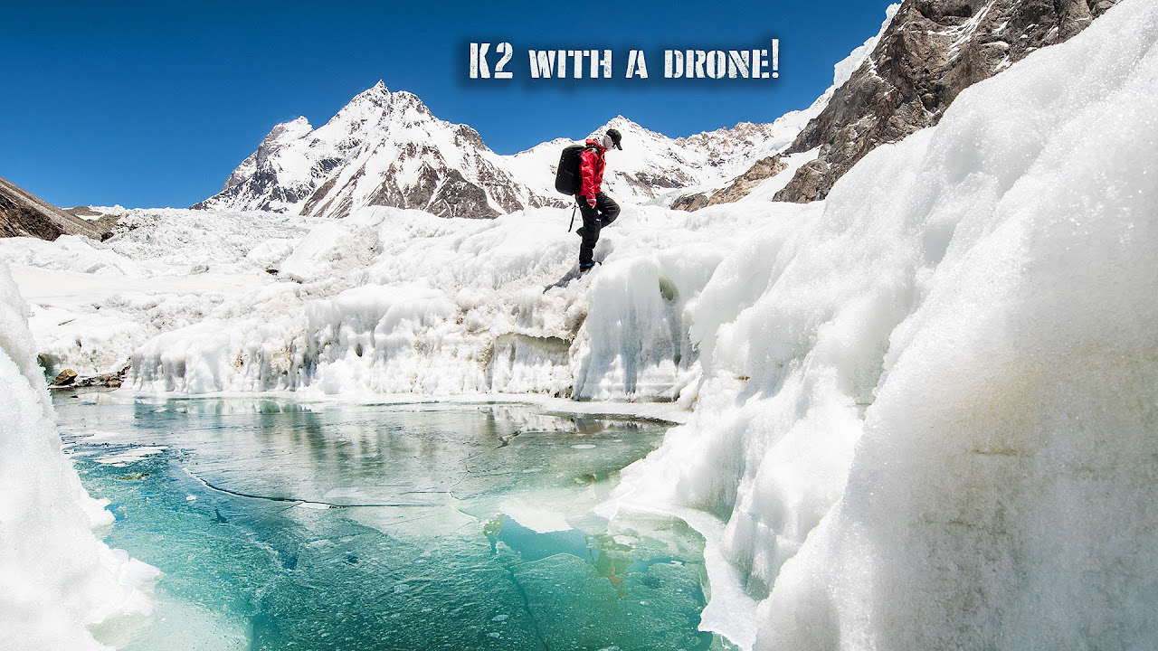
K-2, The Second-Highest Peak in the World
2nd Highest mountain in the world among 8000ers Location: It’s one of the many peaks of the Karakoram Range, on the border of China and Pakistan.
Key Facts & Records
- Elevation: 8,611 m (28,251 ft.)
- First Ascent: Achille Compagnoni and Lino Lacedelli (Italy), 1954
- Coordinates: 35.8818° N, 76.5133° E
- Topography: K-2 is at 22nd by Topography Province.
- Total Ascents: ~520 by 2024
- Fatality Rate: 25%
- Best Season: Late July–August
Interesting Trivia
- K2 remains unclimbed from its East Face till now.
- It’s known as The Dreadful Mountain due to its severe weather and difficult expedition.
- Remarkable first winter ascent achieved in 2021 by a Nepali team led by Nirmal Purja.
K2 offers a beautiful serene sight to look at. This extremely picturesque peak rises singly over 3000 m above the valley bottom at its base. The relief in comparison to height is unique. K2 is far away from travel routes and inhabited areas. It gained the attention of climbers only in the early 20th century. K2 is a consistently steep pyramid on almost all sides, offering very difficult access.
This truth is unwelcome by climbers, who call it the “Dreadful Mountain”, forgetting the artistic scenery and visual appeal of the ranges totally. What else could they expect at an elevation of 8611 m? besides rock, ice, and glaciers. The savagery is highlighted as the fatality rate is 2nd highest peak among 8000 m peaks after Annapurna being first. One in four climbers dies from those who reach the K2 Summits. So far all expeditions to climb this mammoth peak in winter have failed except a few.
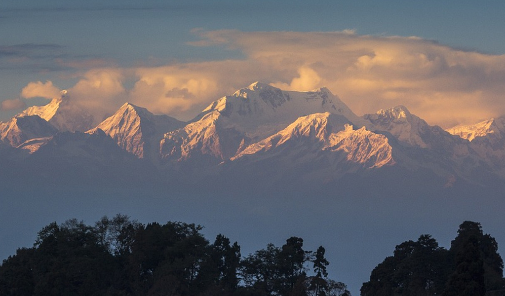
Kangchenjunga, Nepal – 8586m
3rd Highest peaks mountain peak among 8000ers Location: Between the North Sikkim district, India, and Taplejung of Nepal on the Himalaya Range.
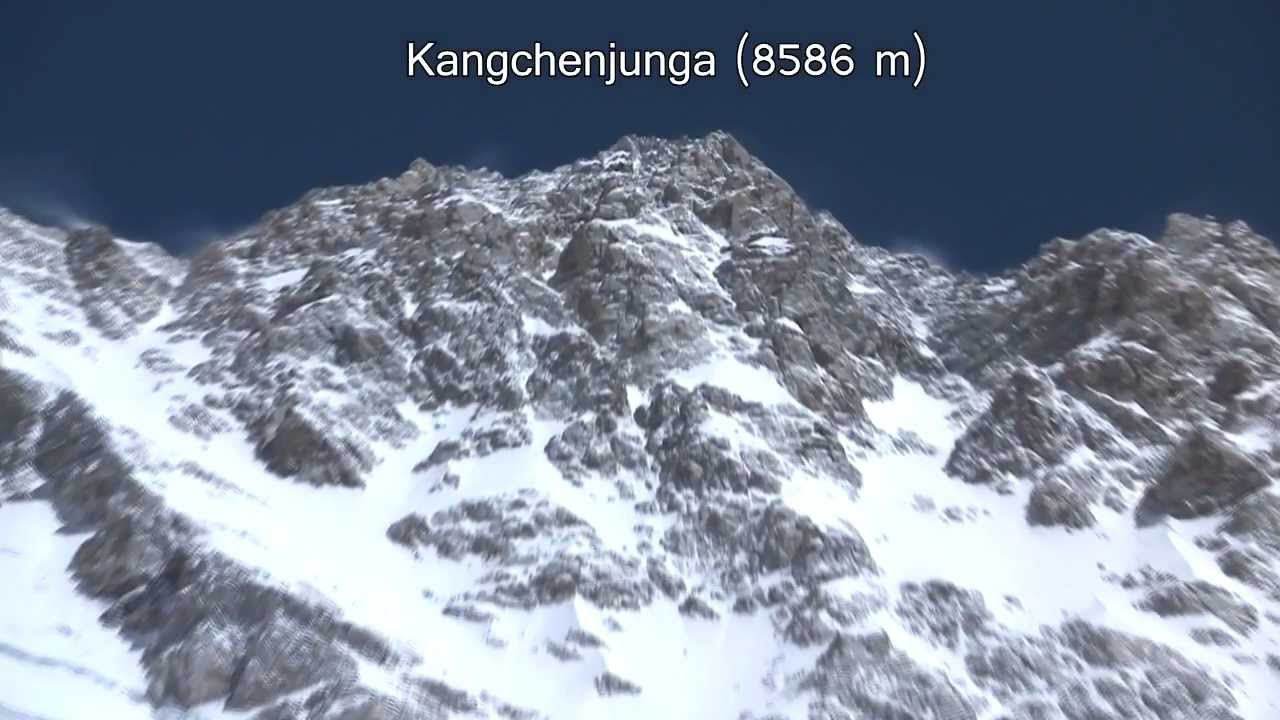
Key Facts & Records
- Elevation: 8,586 m (28,169 ft)
- First Ascent: George Band and Joe Brown (UK), 1955
- Coordinates: 27.7025° N, 88.1475° E
- Fatality Rate: 22%
- Best Season: April–May
- Features: Kangchenjunga means “5 treasures of Snows” because it has 5 peaks, 4 over 8450m 8000nders. Also representing 5 repositories of God, i.e. Gold, Silver, Gems, Grain, and Holy Books.
Interesting Trivia
Climbers traditionally stop a few meters below the true summit out of respect for local beliefs.
The three peaks (Main, Central, and South) are in Sikkim, India while the other two are totally in Nepal. The World Wild Life Fund has protected sanctuaries in both districts to protect wildlife particularly red pandas and snow animals etc.
Kangchenjunga was the highest mountain until 1952. The British Trigonometric Survey in 1849 concluded that the peak XV-later named Mount Everest is the highest while Kangchenjunga came in third position after Mount K2.
Joe Brown and George Band of the British expedition first summited on 25th May 1955. Sikkim holds the summit Sacred, so almost all successful summiteers stop a few feet short of the highest point to honor their sacred beliefs.
Many great ridges originate from the massive Kangchenjunga running in all directions representing a giant “X”. Many lower peaks abound in surrounding areas like Siniolchu (6888m / 22,600 ft), Jannu (7710m / 25294ft), Kabru North (7338m / 24075ft), Kabru South (7316m / 24002ft), Rathong Peak (6678m / 21910ft), Kangchenjunga North (7741m / 25397ft), Twins, Tent Peak and Jongsungla (6120m / 20080ft) 8000nders.
Climbing
Kangchenjunga is famous for the beautiful scenery created by various peaks and valleys and picturesque views with a “White Wall” background. Situated in a remote area and difficult trekking, it is still little explored. India permits very few trekkers each year. The Goecha La Pass is located in front of the South East Face. The tourists appreciate this area along with Green Lake Basin and Zemu Glacier on the North East side.
Lhotse, Nepal – 8516m
4th Highest peak among 8000ers Location: At the border between Tibet, China, and Khumbu, Nepal, on the Himalaya Range.

Key Facts & Records
- Elevation: Main Peak – 8,516 m (27,940 ft), Lhotse Middle (East) Peak – 8,414 m, Lhotse Shar – 8,383 m
- First Ascent: Ernst Reiss and Fritz Luchsinger (Switzerland), 1956
- Coordinates: 27.9617° N, 86.9330° E
- Total Ascents: Over 800
- Fatality Rate: ~2%
- Best Season: May
Interesting Trivia
Connected to Everest via the South Col, which forms part of the same massif.
Lhotse is known for its resemblance to Mount Everest. It has the smallest topographic prominence among 8000nders; rising only 610m (2000ft) above South Col. The South face has the steepest rise of 3.5 km in only 2.25 km of horizontal distance. This very difficult South face is famous for fatalities and only a few ascents. Climbers favor North-West face.
Climbing
The International Himalayan Expedition, led by Norman Dyhrenfurth made an early attempt in 1955, accompanied by 200 local porters. Failing on Lhotse Shar they attempted Lhotse from North West face. At 8100m altitude, they were beaten by severe storms and low temperatures. However, they mapped the Everest area and made their first ascents on smaller peaks in the Khumbu region.
- Lhotse was first climbed on 19th May 1956 by the Swiss team of Ernest Reiss and Fritz Luchsihnger.
- Lhotse Shar was first ascended on 12th May 1979 by Sepp Mayerl and Rolf Walter of Austria.
- Lhotse Middle (East) remained unclimbed till 23rd May 2001, when Eugeny Vinogradsky from the Russian expedition summited along with team members.
Makalu, Nepal – 8485m
5th Highest peaks amongst eight-thousanders Location: Border of Nepal and China – ~19 km (12 miles) southeast from Mount Everest – Himlaya Range.
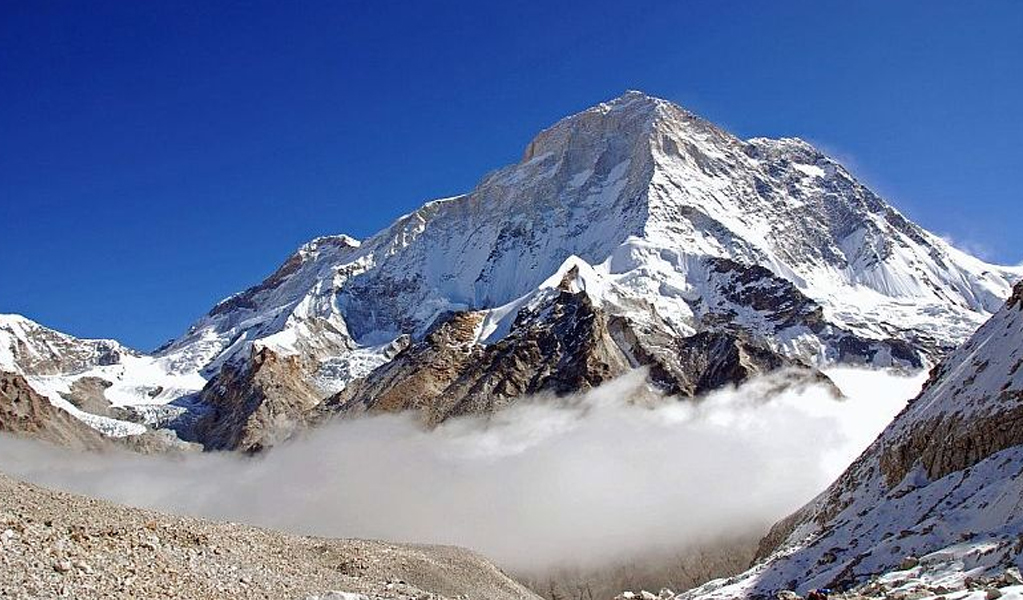

Key Facts & Records
- Peak name: Locally known as Makalu (Nepali), Makaru (Chinese)
- Elevation: 8,485 m (27,838 ft)
- First Ascent: Lionel Terray and Jean Couzy (France), 1955
- Coordinates: 27.8897° N, 87.0883° E
- Fatality Rate: 9%
- Best Season: April–May
Interesting Trivia
- Its knife-edged ridges make it one of the world’s most technical climbs for mountaineers.
- Only 19 km southeast of Everest, often visible from its summit.
- Makalu is a four-sided pyramid-shaped isolated peak.
Its two subsidiary peaks Kangchungtse or Makalu II (7678m / 25190 ft) are 3 km from the main summit. A narrow saddle plateau (7200m) connects it with Chomo Lonzo (7804m / 25604 ft).
Makalu is one of the harder, most difficult to climb mountains in the world. Its steep valley and knife-edged ridges are dangerous to trek. Technical rock/ice climbing is involved at the final peak stages.
Climbing
An American team of Sierra Club, led by William Siri, attempted in 1954 from South West Ridge but, were turned back at 7100m (23300 ft) by a long chain of storms. The subsidiary peaks Makalu II and Chomo Lonzo were ascended in 1954. A French expedition climbed to Makalu on 15th May 1955 by Lionel Terray and Jean Couzy by the North Face and the North West Ridge.
Successful Ascends
- 1970 – The Japanese expedition led by Y. Ozaki and A. Tanaka succeeded.
- 1971 – The technical West Pillar Route was climbed by French men B. Mellet and Y. Seigneur.
- 1980 – Second ascend of West Pillar achieved by a team led by John Roskelley without mastermind support or bottled oxygen.
- 1981 – Polish climber Jersey Kukuczka successfully climbed solo, without bottled oxygen from a new route North West Side.
- 1988 – A French man Marc Batard climbed in one day (after setting camps) via West Buttress.
- 2006 – French Jean Christophe Lafaille disappeared in a first winter attempt.
- 2009 – The first successful winter climb was made by Italian Simons Moro and Kazakh Denis Urubko.
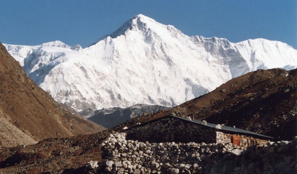
Cho Oyu, Nepal – 8201m
6th Highest among eight-thousanders Location: On the border between China and Nepal – 20 km (~12.4 miles) west of Mount Everest.
Key Facts & Records
- Peak name: Known as Qowowuyag (Nepali) and Zhuo Aoyou Shan (Chinese) locally
- Elevation: 8,188 meters (26,864 ft)
- First Ascent: Herbert Tichy (Austria), Joseph Jöchler, and Pasang Dawa Lama (Nepal), 1954
- Coordinates: 28.0944° N, 86.6608° E
- Fatality Rate: ~1.5% (lowest among 8000nders)
- Best Season: Spring and Autumn
Interesting Trivia
- Known as the “Friendliest 8000nders,” often used for acclimatization climbs before Everest because of its easier climbs compared to other high mountains.
- Cho Oyu means “Turquoise Goddess” in Tibetan.
First attempted by the British Joint Himalayan Committee team and failed at an ice cliff at 6650m / 21820 ft. Finally successfully climbed on 19th October 1954 from North West Ridge by Herbert Tichy of the Austrian expedition.
Cho Oyu lies next to a glaciated pass, the main trading route of Tibetans and Khumbu Sherpas. This easy route and moderate slopes attract immature climbers. The guides consider it the easiest eight-thousand-meter peak.
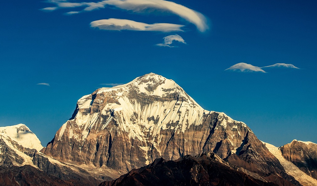
Dhaulagiri, Nepal – 8167m
7th Highest among eight-thousanders Location: North Central Nepal in the Dhawalagiri Zone – Himalaya Range.

Key Facts & Records
- Elevation: 8,167 m (26,795 ft)
- First Ascent: Kurt Diemberger (Austria) and the Swiss-Austrian team, 1960
- Coordinates: 28.696° N, 83.487° E
- Fatality Rate: 16%
- Best Season: April–May
Interesting Trivia
- The name Dhaulagiri means “White Mountain.”
- Once thought to be the world’s highest peak before Kangchenjunga’s accurate measurements.
Dhaulagiri or “White Mountain” is easily accessible from Pokhara, an important town and tourist resort adjacent to the deep Kali Gandaki Gorge. For thirty years it has been the highest peak before shifting this title to Kanchenjunga. It lies next to Annapurna on Kali Gandaki River, facing each other. The South and West faces rise steeply four thousand meters from the base with equally dangerous drops causing fetal accidents to climbers.
Climbing
The first successful climb was on 13th May 1960 by Kurt Diemberger from the North East Ridge route. This route was discovered by an Austrian expedition with “Air Surveillance”. Unfortunately, the fixed-wing aircraft crashed and was abandoned in “Hidden Valley” in the North. Since then numerous successful ascends have been made from all sides.
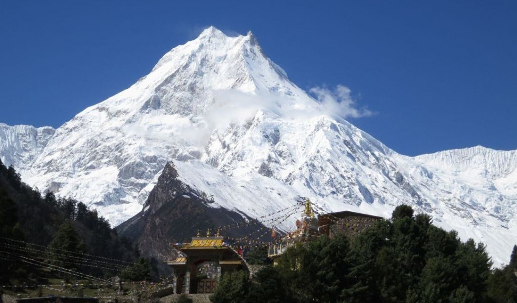
Manaslu, Nepal – 8163m
8th Highest among eight-thousanders Location: Mansiri Himal or Nepalese Himalayas.

Key Facts & Records
- Elevation: 8,163 m (26,782 ft)
- First Ascent: Toshio Imanishi (Japan) and Gyalzen Norbu (Nepal), 1956
- Coordinates: 28.5497° N, 84.5610° E
- Fatality Rate: 13%
- Best Season: Spring and Autumn
Interesting Trivia
- Known as the “Mountain of the Spirit.”
- Modern drones and weather tracking now aid climbers on their challenging icefall routes to make it easier for climbers.
Manaslu or Kutang means “Mountain of Spirit”. 60 Km away from Annapurna, the long ridges and valley glaciers offer easy access from various directions ending in a peak that suddenly towers steeply above its surroundings. A serenic feature when observed from a distance. Manaslu was first climbed on 9th May 1956 by a Japanese expedition led by Toshio
Imanishi and Gyalzen Norbu.
Manaslu Region
The trekking route crosses the Manaslu pass following the ancient salt trading route along Budhi Gandaki river and side trekking the huge peaks above 6500m.
Manaslu region still retains most of its ethnic traits with ancient culture still very visible. Nubri and Tsum groups are maintaining their independent habitats and religious Buddhist lifestyle. The tourists are attracted to the region to see the mountainous landscaping and for acclimatization by trekking the largest peaks in the world. This sub-tropical region has diversified wildlife, including many endangered species of animals. Snow leopards and Pandas are preserved here. Twenty different types of forests, including the blue pines, are found here.
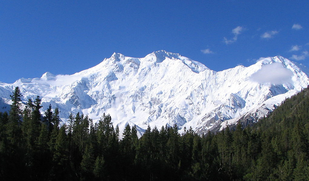
Nanga Parbat, Pakistan – 8126m
9th Highest among 8000nders Location: South of the Indus River, Gilgit – Baltistan in Pakistan on the Western Himalaya Range.

Key Facts & Records
- Elevation: 8,126 m (26,660 ft)
- First Ascent: Hermann Buhl (Austria), 1953
- Coordinates: 35.2375° N, 74.5892° E
- Fatality Rate: 23%
- Best Season: June–July
Interesting Trivia
- Its Rupal Face rises 4,600 m – one of the world’s highest mountain walls.
Nanga Parbat or the “Naked Mountain” was known to be one of the deadliest or “Killer “Mountain” of the 8000nders but has since been tamed, using better climbing techniques.
Main Features: Nanga Parbat offers one of the most picturesque views to observers. Its steep rises and contoured valleys are an appealing contrast. The comparatively gently slopped Rakhiot face rises 7000m (22966 ft) from the Indus River valley to the summit in only 27 km of horizontal distance, a prominent elevation gain. Nanga Parbat has the highest face in the world, the Rupal face, rising 4600m (15000 ft) above its base.
The main ridge or core is all Ice and Rock. Nanga Parbat has many subsidiary peaks above 7000m on its three main faces, Diamir face, Rakhiot, and Rupal. The prominent being the north peak of 7816m. A glacier lake, Latbo is at 4100m near Rupal Face and a shepherd’s village.
Climbing
During early attempts over 30 climbers had died. Nanga Parbat was first climbed successfully on 3rd July 1953 by an Austrian climber Hermann Buhl on a German-Austrian expedition. This feat of Buhl is very dramatic. His companions had turned back while he continued determined and summited at 7 pm, a very hard and time-consuming effort.
On descent darkness caught him and he had to bivouac standing upright on a narrow ledge while skiing, a skillful method of descending. Though completely exhausted, but managed his balance on a fortunate calm night and reached high camp at 7 pm the next day. A forty-hour return trip, without oxygen. He is the only man in mountaineering history, to first ascend an 8000m peak alone.
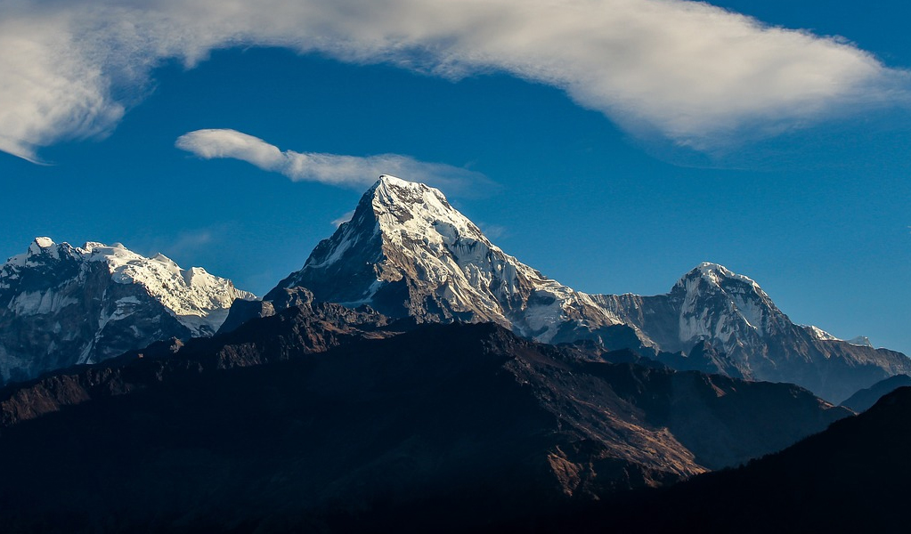
Annapurna I, Nepal – 8091m
10th Highest among eight-thousanders Location: Himalayan Ranges – Nepal.

Key Facts & Records
- Elevation: 8,091 m (26,545 ft)
- First Ascent: Maurice Herzog and Louis Lachenal (France), 1950
- Coordinates: 28.5958° N, 83.8203° E
- Fatality Rate: ~40% (highest among 8000nders)
- Best Season: April–May
Interesting Trivia
- First 8,000-meter peak ever climbed.
- By 2024, over 450 climbers have summited successfully.
- Despite improved logistics, it remains the world’s deadliest mountain.
Annapurna Peak is situated in the Himalayan Range east of a valley cut by the Kali Gandaki River, separating it from Dhaulagiri massif. In local languages, it remains Goddess of Harvest or of Fertility.
The surrounding low trek, an easily accessible area is fairly populated. This makes it a popular trekking field where all the facilities of guest houses, diverse scenery, high mounts, and low-lying villages exist. The King Mahendra Trust for Nature Conservation protects an area of about 7700 sq. km. to conserve natural wildlife and safe trekking. However, Annapurna Peaks are the world’s most dangerous mountain to climb. It still claims a fatality rate of 40%.
Trekking Routes
There are 3 major routes.
- The Johnson and Muktinath
- The Annapurna Sanctuary Route
- Annapurna Circuit
The Pokhara Town is usually the starting point for short treks.
Expeditions
Annapurna I was first climbed on 3rd June 1950 by a French expedition headed by Maurice Herzog and others. This highest climb record was broken three years later when Mount Everest was surpassed.
A British expedition climbed from the South Face of Annapurna in 1970 led by Don Whillans. While descending, one team member Ian Clough was killed by the falling ice pillar.
The American women’s Himalayan expedition led by Arlene Blum was the first all-women team’s successful attempt on 15th October 1978.
On 3rd February 1987 Annapurna I was first summited in winter by the Polish team by Jersy KuKuczka and Artur Hajzer.
The first solo climb by Slovenian, Tomaz Humar was made in October 2007.
The successful attempts since 2005 total 103 while 56 lives were lost by Avalanches and otherwise, killing some renowned climbers also.
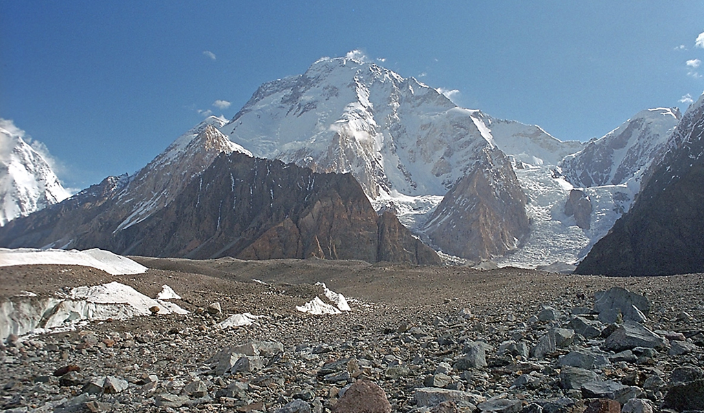
Gasherbrum I (KV), Pakistan – 8080m
11th Highest among eight-thousanders Location: Karakoram Range of the Himalayas – Border of Pakistan and China.

Key Facts & Records
- Elevation: 8,080 m (26,509 ft)
- First Ascent: Pete Schoening and Andy Kauffman (USA), 1958
- Coordinates: 35.7242° N, 76.6966° E
- Fatality Rate: ~10%
- Best Season: June–August
Interesting Trivia
- Gasherbrum I or “Beautiful Mountain” is also known to be the “Hidden Peak”, being very remotely placed
- Gasherbrum means “Shining Wall” in Balti.
- Often overshadowed by K2, though it poses similar challenges.
Various Ascends
- 1936: A French expedition reaches only 6900m (22630 ft.)
- 1958: An American team succeeds to summit.
- 1975: Reinhold Messner and Peter Habeler reach the summit from North West Route.
- 1977-1982: Successful attempts made by various teams from different routes.
- 1982: First woman reaches summit. French Marie Jose Valencot. Her husband Sylvain Saudan performs the first sky descent from 8000m peak to base camp.
- 1985: Benoit Chamoux made a solo summiting.
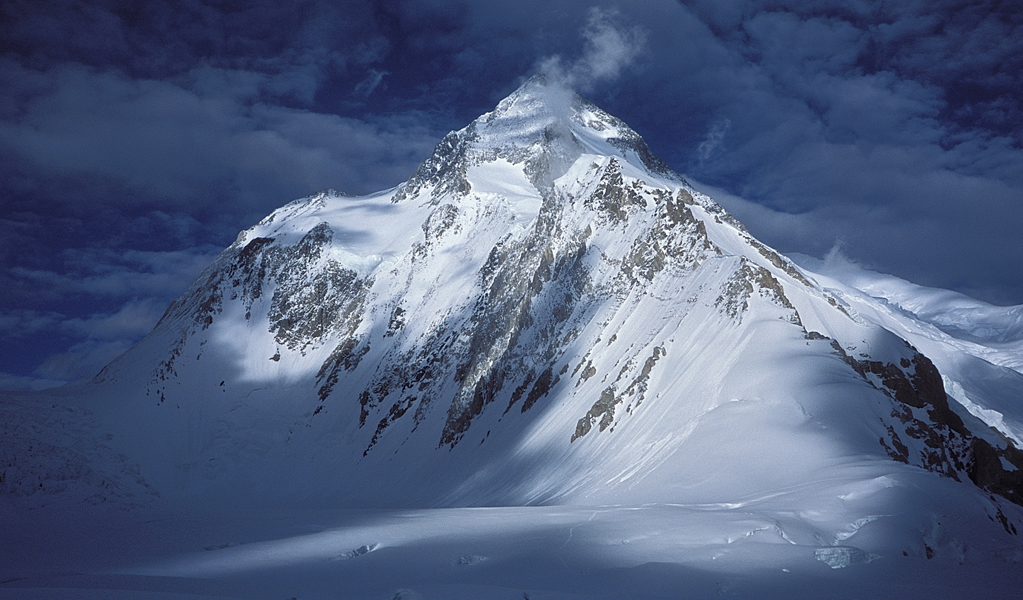
Broad Peak (KIII), Pakistan – 8051m
12th Highest among eight-thousanders Location: Border of Pakistan and China – 8km from K2.
Key Facts & Records
- Elevation: 8,051 m (26,414 ft)
- First Ascent: Fritz Wintersteller, Marcus Schmuck, Hermann Buhl, and Kurt Diemberger (Austria), 1957
- Coordinates: 35.812° N, 76.565° E
- Fatality Rate: ~8%
- Best Season: June–August
Interesting Trivia
Named “Broad Peak” for its long summit ridge stretching over 1.5 km.
The Broad Peak is part of Gasherbrum massif. Originally termed K3, but closer look measured the peak about one and a half kilometer long. Thus the name Broad Peak originated.
Climbing
- Fritz Wintersteller and Kurt Diemberger reached the fore peak (8051m) without supplemental oxygen and porters on 9th June 1957.
- In July 2007, an Austrian team climbed Broad Peak to bring the corpse, of Markus Kronthaler who died a year earlier, from 8000nders.
- Simone Moro made two winter attempts on Broad Peak but failed.
- All five eight-thousand-meter peaks in Pakistan still remain unsurpassed in winter.
- In 1983 Krystyna Palmowska from Poland was the first woman summiter.
Gasherbrum II (KIV), Pakistan – 8034m
13th Highest among eight-thousanders Location: Border of Pakistan and China in the Karakoram Range.

Key Facts & Records
- Elevation: 8,035 m (26,362 feet)
- First Ascent: Fritz Moravec, Josef Larch, and Hans Willenpart (Austria), 1956
- Coordinates: 35.758° N, 76.662° E
- Fatality Rate: ~5%
- Best Season: June–August
Interesting Trivia
- It’s the most frequently climbed Karakoram 8000nders.
- Offers panoramic views of Baltoro Glacier and surrounding peaks.
The Gasherbrum II offers smoother ascent which has fewer hazards like ice falls and Avalanches. The climbers prefer it as an initial starter. A permit is required for climbing costing around US$ 2000 per person.
Climbing
First climbed on 8th July 1956 by Fritz Moravee from Austria.
- 1975: The French group made the second summit with the death of one member.
- 1975: Polish women’s team ascended led by Wanda Rutkiewicz.
- 1979: Sixth and seventh ascends by Chilean and German expeditions.
- 1982: Reinhold Messner tops with two Pakistani’s Nazir Sabir and Sher Khan.
- 1983: Jerzy Kukuczka climbed from East Ridge without oxygen.
- 1984: Messner and Hans Kammerlander traverse Gasherbrum I and II without returning to base camp.
- 1984: First ski descent by a French team led by Daniel Croisot from 7800m.
- 2005: A Turkish team with two women scaled Gasherbrum II on 22nd July.
- 2007: three Italians led by Karl Unterkircher, topped from new way on North face.
Shisha Pangma, Tibet – 8027m
14th Highest among eight-thousanders Location: Nyalam County, Tibet, China on the Himalaya Range.


Key Facts & Records
- Peak Name: Known as Shishasbangma or Xixiabangma (Chinese)
- Elevation: 8,027 m (26,335 ft)
- First Ascent: Hsu Ching and the Chinese team, 1964
- Coordinates: 28.3525° N, 85.7792° E
- Fatality Rate: 8%
- Best Season: April–May
Interesting Trivia
- Shisha Pangmalast of the 14 8000nders to be summited.
- Its Central Summit (8,008 m) is often mistaken for the Main Summit (8,027 m), leading to disputed records.
Shisha Pangma means either “Place of Saint” or “Mastermind Women” in different languages. It is entirely in Tibet near the Nepali border. The Jugal Himal and Langtang Himal run along the Tibet / Nepal border. This peak has less dramatic relief as compared to major Himalayan peaks. This is probably the easiest of all 8000m peaks.
Vehicle travel is possible up to Base Camp at 5000m (16400 ft). The steeper South West face is difficult to climb as a long span of ascent is on a 50o slope. The Chinese and Tibetan authorities have restrictions on foreign visitors resulting in fewer trekking opportunities.
Climbing
Shisha Pangma was summited from North Face on 2nd May 1964 by a Chinese expedition led by Xu Jing.
- 1982: From the British route on South West Face a British team led by Doug Scott reached the top.
- 2004: Jean Christophe Lafaille (France) climbed solo from South West Face on 11th December, claiming it to be a winter ascent.
- 2005: First clear winter ascent by Piotr Morawski (Poland) and Simone Moro (Italy).
Climbers Who Conquered All 14 8000nders
Only a few elite mountaineers have successfully climbed all 14 peaks above 8,000 metres without the use of supplementary oxygen – a feat that demands incredible resilience.
- Reinhold Messner (Italy) – First to complete all 14 (1986).
- Jerzy Kukuczka (Poland) – Completed within 8 years (1987).
- Nirmal “Nimsdai” Purja (Nepal) – Fastest ascent of all 14 in just 6 months and 6 days (2019).
- Kim Chang-ho (South Korea) – First without oxygen in the shortest time (2013).
And the list goes on, as over 50 climbers have now accomplished this remarkable feat.
Changing Climates for the Top 8000 Meter Peaks
The Himalaya and Karakoram glaciers are melting at rates without precedent; in recent years, they have lost more than 40% of their ice mass since the Little Ice Age in the recent decades.
East Nepal and Bhutan have experienced the most rapid losses, adding to 10 times the rate of Little Ice Age melts. This is a threat to the water sources of 1.3 billion people across South and Central Asia.
Warmer temperatures mean:
- More avalanches that are almost impossible to predict
- Rockfalls from thawing permafrost
- Less time for climbing
Now, conservationists and local governments advocate eco-friendly expeditions and waste-removal missions, eco-sustainable treks from lodging to consistent trails on foot that respect these fragile ecosystems.
The Fourteen 8000nders – A Comparison Table
| Rank | Mountain | Height (m) | Country | Range | First Ascent | Fatality Rate |
|---|---|---|---|---|---|---|
| 1 | Mount Everest | 8,848.86 | Nepal/China | Himalaya | 1953 | 3% |
| 2 | K2 | 8,611 | Pakistan/China | Karakoram | 1954 | 25% |
| 3 | Kangchenjunga | 8,586 | India/Nepal | Himalaya | 1955 | 22% |
| 4 | Lhotse | 8,516 | Nepal/China | Himalaya | 1956 | 2% |
| 5 | Makalu | 8,485 | Nepal/China | Himalaya | 1955 | 9% |
| 6 | Cho Oyu | 8,188 | Nepal/China | Himalaya | 1954 | 1.5% |
| 7 | Dhaulagiri I | 8,167 | Nepal | Himalaya | 1960 | 16% |
| 8 | Manaslu | 8,163 | Nepal | Himalaya | 1956 | 13% |
| 9 | Nanga Parbat | 8,126 | Pakistan | Himalaya | 1953 | 23% |
| 10 | Annapurna I | 8,091 | Nepal | Himalaya | 1950 | 40% |
| 11 | Gasherbrum I | 8,080 | Pakistan/China | Karakoram | 1958 | 10% |
| 12 | Broad Peak | 8,051 | Pakistan/China | Karakoram | 1957 | 8% |
| 13 | Gasherbrum II | 8,035 | Pakistan/China | Karakoram | 1956 | 5% |
| 14 | Shishapangma | 8,027 | China (Tibet) | Himalaya | 1964 | 8% |
Frequently Asked Questions
Annapurna I, with a ~40% fatality rate.
Cho Oyu, which is often an adventure-seeker’s first 8000er.
More than 6,000 successful ascents as of 2024.
Nepal, home to 8 of the 14 peaks, either fully or partially.
Aconcagua (Argentina) a 6.961 m.
Be sure never to limit yourself. Most people limit themselves to what they feel they are able to do. Bear in mind that you can go so far as your mind lets you.
thanks very much, I must comment that your site is excellent!
I really enjoy your blog. I feel I should let you know I stumbled upon your blog through Yahoo.
Would it be alright if I link up to this blog, from my website?
Great article on the mountains, shame you had to ruin it at the beginning though with talk of a “creator” and an “almighty one”. Not really necessary. Thanks for the mountain lowdown though. That part I enjoyed.