K2 Elevation “The Savage Mountain” The Challenge of Climbing K2


WU Peaks Evidence Guide · K2
Why K2 is so difficult, how its main routes developed, and what its climbing history really shows—without reducing the mountain to a sensational nickname or a single death statistic.
K2 at a glance
Stable facts first
Short answer
Why K2 remains so difficult
K2 is difficult because several dangers arrive together: steep technical ground, extreme altitude, rapidly changing weather, a demanding descent and very limited rescue options. The Abruzzi Spur is the route most teams use, but calling it the “normal route” does not make it ordinary or safe. Historic death totals also cannot tell an individual climber their personal risk unless the route, period, exposure and expedition style are comparable.
Expedition synthesis
Four pressures shape every climb
Expedition accounts, accident reports and rescue records repeatedly point to four connected pressures. They explain why trouble can escalate, but they do not describe today’s conditions on the mountain.
Terrain begins early
K2’s technical rock, mixed climbing, snow and ice begin well below the summit. Turning back can therefore remain difficult long before a team reaches the Bottleneck.
Weather narrows choices
High winds and storms can hold teams in camp for days. When a short window finally opens, more climbers may move at once while already carrying the effects of waiting at altitude.
Altitude weakens judgment
Above 8,000 metres, low oxygen, cold, fatigue and dehydration make technical work harder and sound decisions more difficult.
Descent decides success
Reaching the summit is only half the journey. Climbers must descend through exposed terrain when their energy, time and concentration are already at their lowest.
Repeated mistakes
Six K2 myths corrected
The one-in-four claim
This mixes eras and often confuses deaths with summiters. The denominator, years, population and route exposure must be stated.
The “normal route” myth
The Abruzzi Spur is the standard route, not a low-risk route. It still includes House’s Chimney, the Black Pyramid and high exposure.
Beyond the Bottleneck
It is a major objective-hazard zone, but storms, avalanches, falls, rockfall, illness and descent exhaustion occur elsewhere.
K2 is not Everest
The two mountains differ in access, common route character, infrastructure, weather patterns and rescue capacity.
Who made the winter first?
Ten Nepali climbers made the first winter ascent on 16 January 2021. Sadpara disappeared during a later attempt that season.
History is not a forecast
A historical report cannot establish present snow, serac, rope, weather or crowding conditions.
K2 reality panel
Five expedition realities
Altitude
Hypoxia, acclimatization and altitude illness.
Technical terrain
Rock, mixed ground, fixed lines and descent.
Objective hazards
Serac, avalanche, icefall and rockfall exposure.
Weather & timing
Wind, storms, waiting and summit-window compression.
Rescue & ethics
Remoteness, labor, crowd decisions and limited evacuation.
K2 in the field
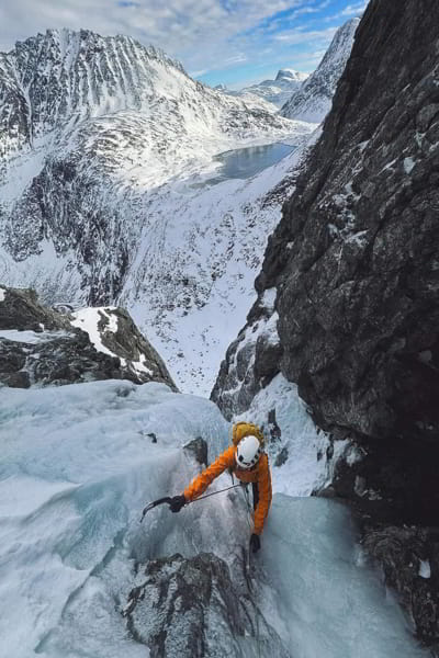
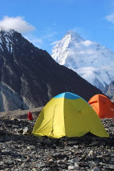
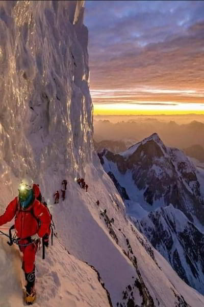
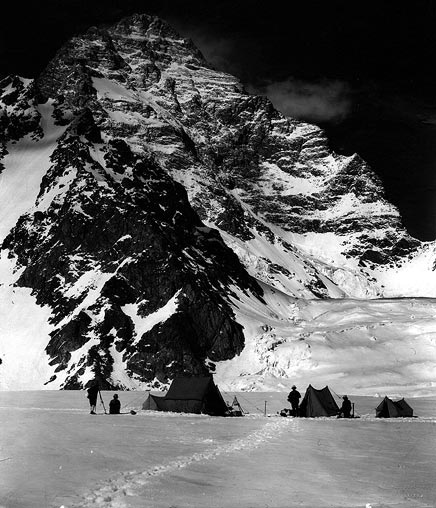
Terrain above the camps
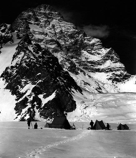
These archive images help readers understand K2’s terrain and scale. They should not be treated as evidence of current snow, ice, ropes or route conditions.
The descent problem
The descent still awaits
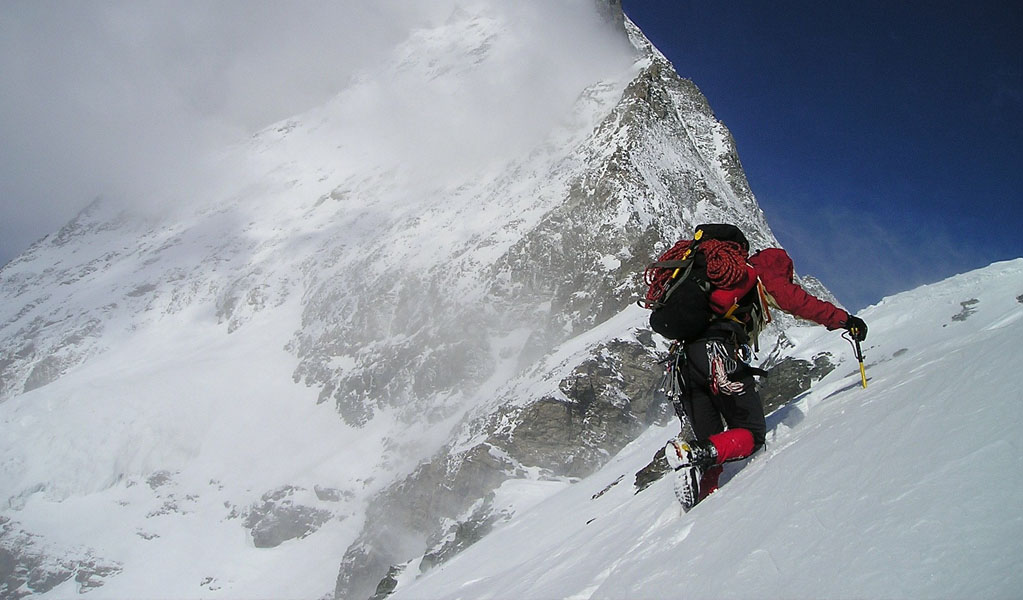
A K2 ascent is not complete at the summit. Climbers still have to cross the same unforgiving terrain with less daylight, less energy and reduced concentration.
Pathfinder
Choose your question
How high and where?
Use the stable profile: 8,611 m, Karakoram, Pakistan–China border.
Who first climbed it?
Separate 1954 summit history from the Bonatti–Mehdi bivouac and later controversy.
Why do people die?
Read incident mechanisms and exposure, not an undated headline ratio.
What about base camp?
Trekking to K2 Base Camp is a separate undertaking from climbing K2 and still requires current local planning.
Route profiles
K2 route profiles
The profiles below explain the general character and history of each route. They are not climbing instructions, reports of current conditions or recommendations for choosing a route.
Abruzzi Spur
Southeast Ridge · Pakistan side
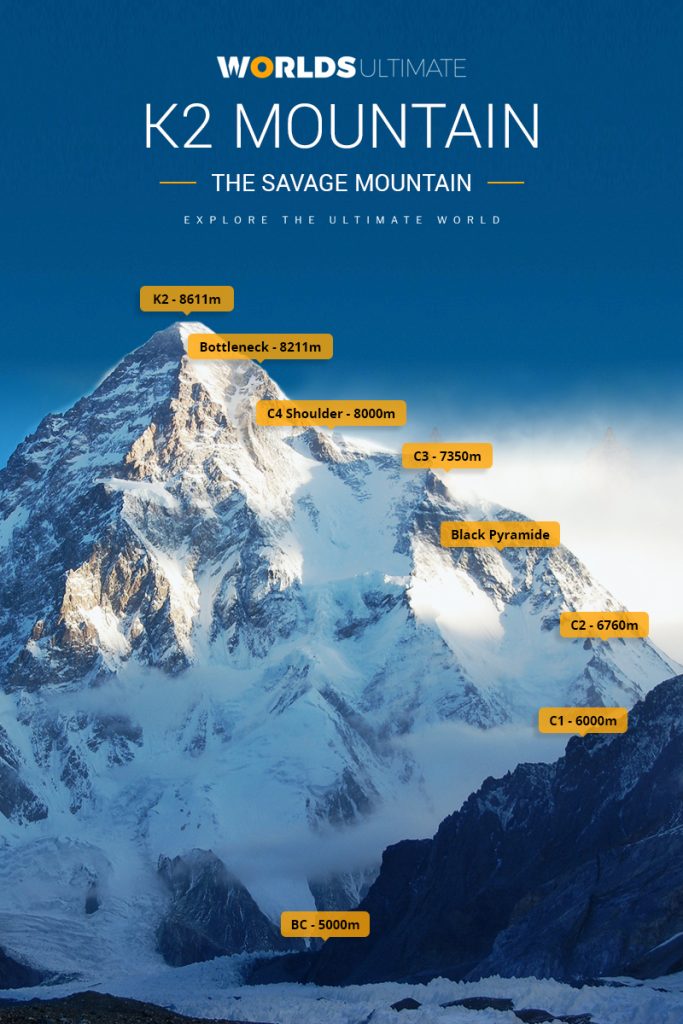
The standard route follows the ridge explored by the Duke of Abruzzi’s 1909 expedition. Commonly named landmarks include House’s Chimney, the Black Pyramid, the Shoulder and the Bottleneck.
- Character
- Sustained rock, mixed and snow/ice terrain.
- Key context
- Most infrastructure does not mean low consequence.
- Evidence status
- Strong historical documentation; conditions dynamic.
Cesen / Basque Route
South-southeast spur · Pakistan side
A more direct spur that generally joins the Abruzzi system higher on the mountain. It avoids some lower Abruzzi landmarks but not the extreme-altitude summit terrain.
- Character
- Direct, steep mixed climbing.
- Key context
- Route choice does not remove upper-mountain exposure.
- Evidence status
- Documented ascents; fewer comparable records.
Northeast Ridge
Long ridge · first completed 1978
The 1978 American ascent completed a long northeast-ridge line before traversing into upper terrain. Its history is distinct from the Abruzzi Spur.
- Character
- Long, corniced and committing ridge.
- Key context
- Length and exposure complicate retreat.
- Evidence status
- Strong expedition-history record.
North Ridge
Remote northern approach
The North Ridge was first climbed in 1982. Access and logistics differ substantially from the Pakistan-side routes, so statistics and narratives should not be merged casually.
- Character
- Remote, steep and technically serious.
- Key context
- Very limited modern comparison data.
- Evidence status
- Historical accounts; current access varies.
West Face & other lines
Rarely attempted technical objectives
K2’s faces and ridges include exceptionally difficult lines attempted by small elite teams. The 2024 deaths of Kazuya Hiraide and Kenro Nakajima on the West Face underline that these projects are not comparable with commercial-route traffic.
- Character
- Highly technical, sparse precedent.
- Key context
- Small samples defeat simple percentages.
- Evidence status
- Expedition-specific reporting.
Legacy K2 route visual
The established Abruzzi landmarks in one viewThis long-standing WU image identifies the broad progression from base camp to Camps 1–4, the Black Pyramid, Shoulder and Bottleneck. Heights are approximate labels from the original graphic—not live camp positions, route instructions or current conditions.Original WU media-library asset · retained for search continuity
Visual evidence break
K2 at expedition scale
This film is embedded inside the article so readers stay in the evidence guide. It supplies visual context, not proof of current route conditions.
Expert context
How the evidence fits together
UIAA
Baseline for the classic 14 eight-thousanders.
American Alpine Journal
Primary and near-primary expedition and accident accounts.
Wilderness Medical Society
Current clinical guidance, not individualized care.
Gilgit-Baltistan
Current permit and official tourism information.
ICIMOD
Regional cryosphere research with explicit local limits.
Name, place & geology
Name, location and geology
A survey label that endured
Thomas Montgomerie used “K2” during the Great Trigonometrical Survey in 1856: the second peak sketched in the Karakoram survey sequence. Unlike several neighboring peaks, the survey label became the globally dominant name.
Pakistan–China border
K2 rises in the Karakoram on the border between Pakistan-administered Gilgit-Baltistan and China-administered territory. The standard expedition approach is from Pakistan through the Baltoro region.
Not a limestone pyramid
K2 is built largely from metamorphic and igneous rocks within the complex Karakoram geology. The old article’s blanket limestone-and-shale description was removed.
Deaths, rescue & accountability
Lessons from major incidents
No single, undated fatality ratio can explain K2. Looking at individual incidents shows how storms, terrain, decisions, equipment, working conditions and rescue limits have combined in different ways.
The Belay
During an attempted rescue of the ill Art Gilkey, a fall involving several team members was arrested by Pete Schoening’s ice-axe belay. Gilkey was later lost. The episode is remembered for team responsibility, not summit success.
A deadly season
Thirteen climbers died on K2 during the 1986 season in separate accidents and a catastrophic storm sequence. “1986 disaster” is useful shorthand only if the separate events are not collapsed into one cause.
Serac and descent crisis
Eleven climbers died after a serac collapse and resulting damage to fixed lines near the Bottleneck during a crowded summit and descent sequence. The event cannot be reduced to the icefall alone.
Winter triumph and loss
Ten Nepali climbers made the first winter ascent on 16 January. In February, Ali Sadpara, John Snorri and Juan Pablo Mohr disappeared during a separate summit attempt and were later declared dead.
Mohammad Hassan’s death
High-altitude worker Mohammad Hassan died near the Bottleneck after a fall. Accounts disputed what rescue was possible; Pakistani authorities announced an investigation. The incident raised enduring questions about equipment, training, employer duty, crowd behavior and the value assigned to local labor.
Fatal West Face fall
Japanese alpinists Kazuya Hiraide and Kenro Nakajima fell while attempting a new line on K2’s West Face. The incident belongs to a small-team technical context, not the standard-route denominator.
Rockfall on descent
Chinese climber Guan Jing died after being struck by falling rocks during descent. Her body was later recovered in a Pakistani–Nepali operation, illustrating both the objective hazard and the human cost of recovery.
Weather, altitude & medical context
Weather, altitude and illness
A forecast is not safety
Wind and storm timing shape every high-camp and summit decision. A favorable forecast does not remove terrain, crowding or descent risk.
Altitude reduces capacity
Acclimatization reduces some risk but does not normalize function above 8,000 metres.
Recognise medical emergencies
Symptoms and decisions require qualified expedition medical planning. This page does not provide diagnosis or treatment instructions.
Small problems combine
Cold injury, dehydration, exhaustion and delayed descent can interact with technical errors and altitude illness.
Clinical framing follows the Wilderness Medical Society’s 2024 altitude guidance summary. It is general evidence, not personal medical advice.
People & mountaineering history
People who shaped K2
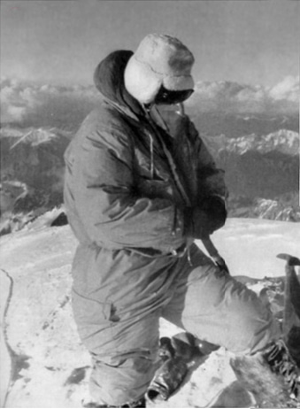
The first ascent is central to K2’s history, but it is not the whole story. Surveyors, high-altitude workers, rescuers, women climbers and Pakistani mountaineers also shaped what happened on the mountain and how those events are remembered.
Thomas Montgomerie
Surveyed and labeled K2 during the Great Trigonometrical Survey.
Duke of the Abruzzi
His expedition explored the southeast ridge that became the standard Abruzzi Spur.
Charles Houston & Pete Schoening
Houston led the American team; Schoening’s belay stopped a mass fall during the retreat.
Compagnoni & Lacedelli
Reached the summit on 31 July in Ardito Desio’s Italian expedition.
Walter Bonatti & Amir Mehdi
Carried oxygen high on the mountain and survived an exposed bivouac; Mehdi suffered devastating frostbite.
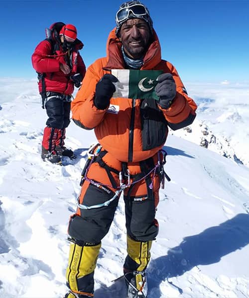
Ashraf Aman
Became the first Pakistani climber to summit K2.
Wanda Rutkiewicz
Became the first woman to summit K2. Later tragedy does not justify the old “women’s curse” myth.
Ten Nepali winter climbers
The climbers joined forces and reached the summit together on the first successful winter ascent.
Ali Sadpara
A leading Pakistani high-altitude mountaineer who disappeared on K2 with John Snorri and Juan Pablo Mohr in February 2021.
Environmental change
Reading a changing Karakoram
Glaciers and snow are changing
ICIMOD documents accelerating cryosphere change across the Hindu Kush Himalaya. Regional trends matter for water, access and hazards.
Regional evidence has limits
It cannot tell a reader the stability of one serac, slope or glacier crossing on a particular day.
Date every condition claim
Route reports, satellite observations and expedition accounts must keep their year, season and location attached.
Comparison framework
K2 and Everest compared
| Lens | K2 | Everest | What the comparison can support |
|---|---|---|---|
| Elevation | 8,611 m | 8,848.86 m | Everest is 237.86 m higher. |
| Common-route character | Sustained technical and steep terrain | Different technical profiles on Nepal and Tibet routes | Route demands differ; “harder” needs a defined lens. |
| Infrastructure | Smaller expedition system and rescue capacity | Much larger guiding, forecasting and rescue ecosystem | Support context changes exposure and response. |
| Historical data | Smaller samples, strong era effects | Larger and more studied dataset | Raw percentages should not be compared without denominator and period. |
| Current conditions | Dynamic on both mountains | Neither mountain can be reduced to its historical reputation. | |
WU four footprints
Four expedition footprints
A useful account of K2 looks separately at the people involved, the physical mountain, its climbing history and the changes affecting future expeditions.
Human footprint
Climber judgment, high-altitude labor, support, oxygen strategy, teamwork and rescue responsibility.
Physical footprint
Altitude, rock, ice, glaciers, slope, weather and remoteness.
Historical footprint
Route development, expedition records, fixed-line practice and changing tactics.
Change footprint
Cryosphere change, forecasting, permits, commercialization and evolving recovery capacity.
Sources, limits & corrections
Evidence behind this guide
Written by Maqsood A. Rahim · Updated and evidence-reviewed by the WorldsUltimate Editorial Desk · Last reviewed 19 September 2026
These sources answer different questions. Peak-recognition records, expedition histories, medical guidance, current reporting, local administration and environmental research should not be treated as if they provide the same kind of evidence.
- UIAA · 8000m peaks — classic-14 recognition baseline.
- American Alpine Journal · K2 1953 — expedition, rescue and recovery record.
- American Alpine Journal · K2 1986 — season and storm accounts.
- American Alpine Club · K2 2008 — retrospective incident account.
- Associated Press · Mohammad Hassan investigation — 2023 incident and dispute.
- Associated Press · Guan Jing recovery — 2025 death and recovery.
- Wilderness Medical Society · 2024 altitude summary — clinical context.
- Gilgit-Baltistan Tourism Department — official permit and tourism context.
- ICIMOD Library — regional cryosphere research.
- WU · The 14 Eight-Thousanders — parent-system evidence framework.
Corrections & updates
Mountain records and conditions change
This guide will be updated when verified expedition records, official findings, medical guidance or cryosphere research materially changes the interpretation.
Audience submission · Add your journey
Have you travelled on one of these routes?
Your story enters a private moderation inbox. Automated spam and duplicate checks run first; a WU editor must then verify and approve it before it can appear publicly.
Audience submission · private until human approval

Good. Amazing fact
Jordi Corominas isnt Italian… Half assed article at best.
Thanks for the correction
Very interesting, thanks for sharing!